....The earth has a heat problem. More sunlight (energy) falls at
the equator each day than at the higher latitudes. In fact, the
average daily energy striking Oregon (44oN latitude) on the
hottest summer day of the year is about equal to an average day at the
equator. Luckily, energy tends to flow from hot areas to colder
areas by convection. The temperature difference between the equator and
the poles fuels Planet Earth's air and water circulation. Warm air
rising at the equator is replaced by cooler air draining off of
higher latitudes (Figure1).
This air flow forms a circle of rising air at the equator and a
corresponding downward column of descending air forming the
subtropical high pressure zone (Figure2) at around 20 to 30O latitude.
A second cell redistributes cold dense air from the poles southward.
Although air is trying to travel directly from high to low
pressure zones, the earth is rotating under it, giving the impression
to those of us seeing it from a fixed point on the earth in the
Northern Hemisphere, that air is flowing in a clockwise motion away
from high pressure and in a counter clockwise motion towards low
pressure cells. This produces the characteristic seasonal zonal winds
that are seen on Planet Earth at different latitudes. Because winds
redistribute moisture as well as energy, zonal precipitation
patterns follow air global circulation patterns with areas of
rising air getting precipitation and areas of descending air having
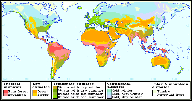
relatively little precipitation. Surface winds interact with mountain ranges to produce the world's major climatic zones (Figure 3) with their corresponding vegetation zones (Figure 4).
